Components
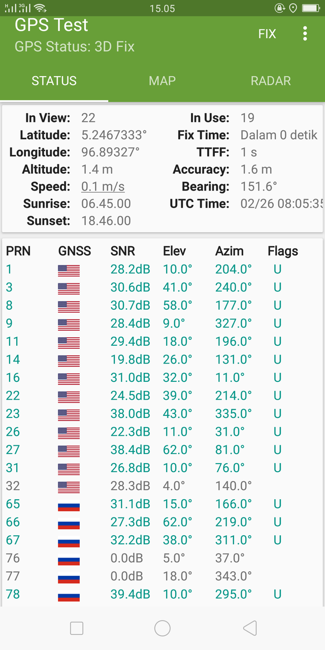
A GPS test application is an application that displays real time satellite viewing of a user's device. A tool to test gps for platfom engineers, developers and power users and help users to understand why GPS users do not work and fix it. And also equipped GPS satellites usa navstar, Glonass, Qzss, beidou.
Proposal
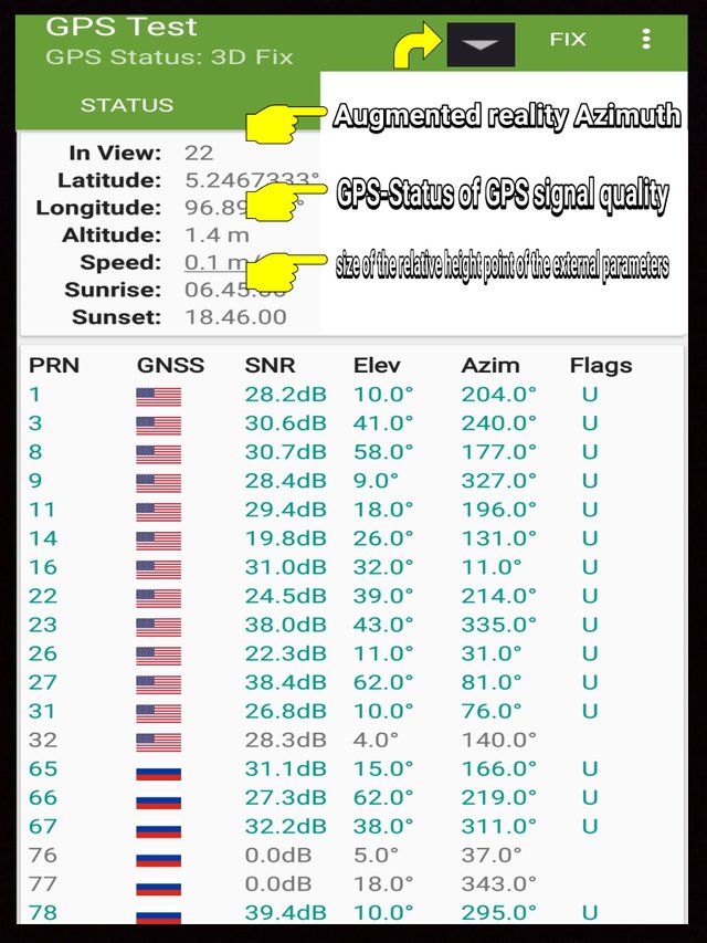
After installing the Gps Test application the user can display real time satellite display to the user's device. A tool to test gps for platfom engineers, developers and power users and help users to understand why GPS users do not work and fix it. As a user I propose to the developer to add "Augmented reality Azimuth" feature and then "gps-status of gps signal quality" feature also "size of the relative height point of the external parameters" section in GPS Test settings.
Mockups / Examples
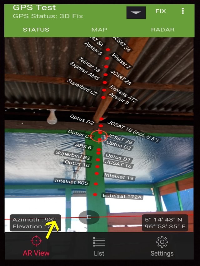
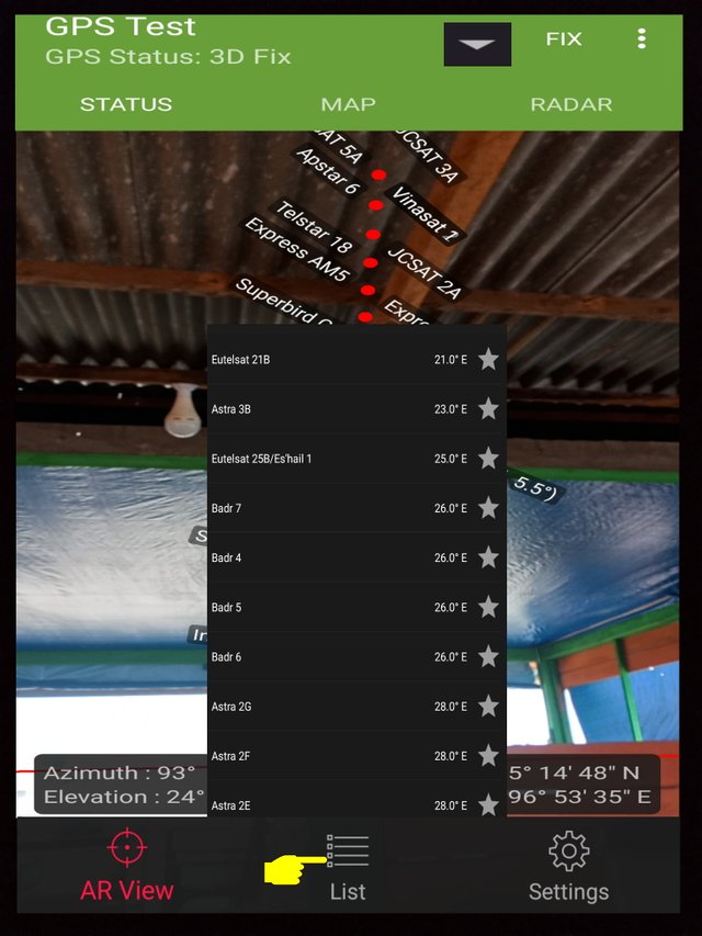
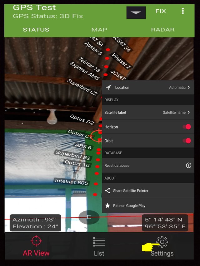
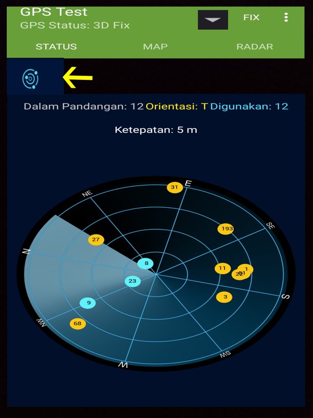
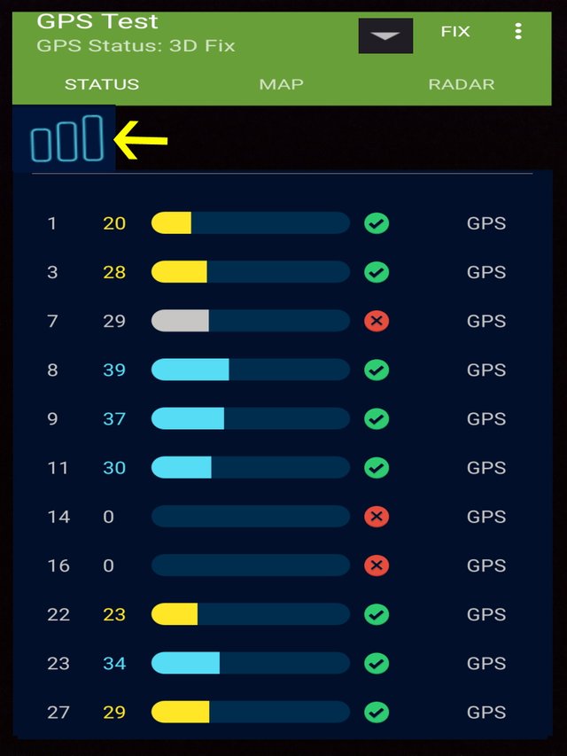
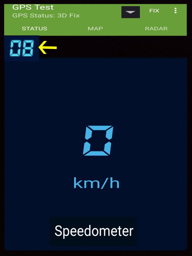
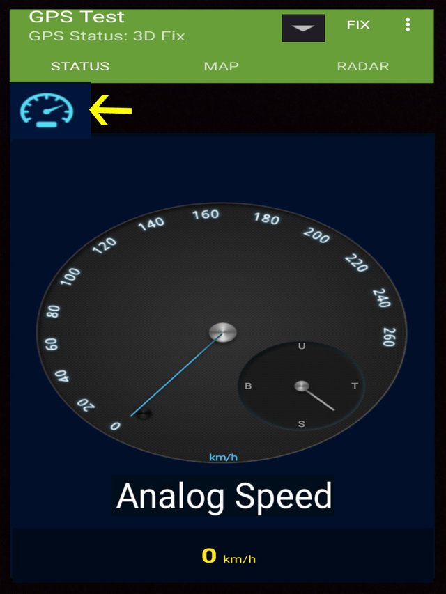
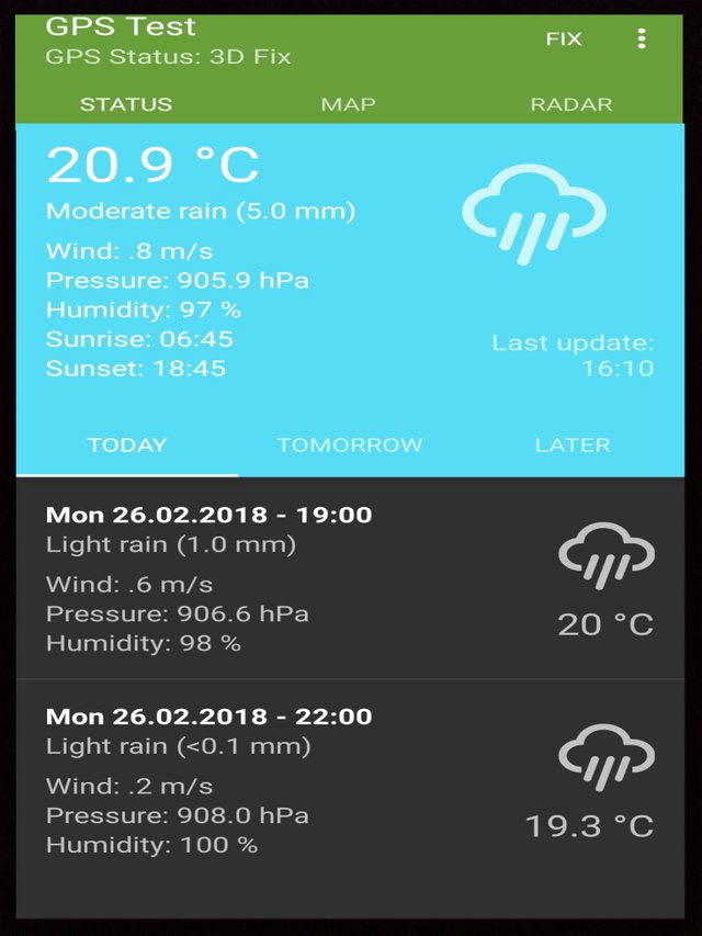
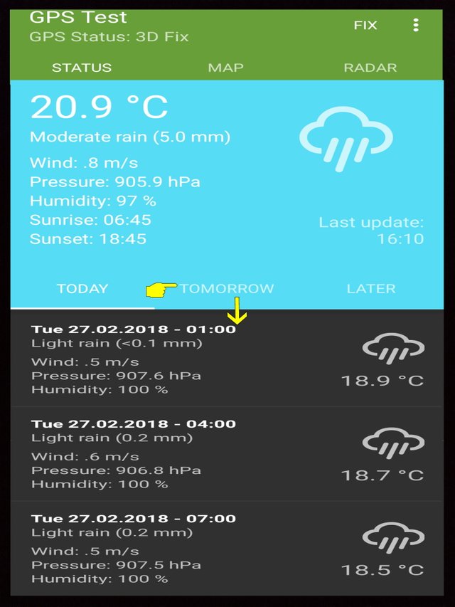
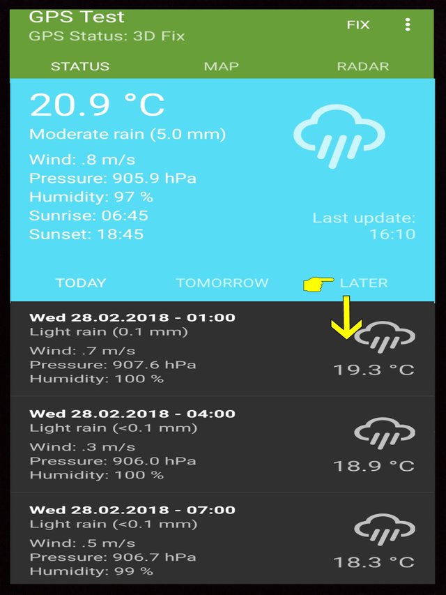
This is an example of a picture after the developer added the "Augmented reality Azimuth" feature and the "gps-status of gps signal quality" feature and the "size of the relative height point of the external parameters" feature in the GPS Test settings.
Benefits
With the Augmented reality Azimuth feature can view satellite and target users directly screen the user. Elavation and angle polarization are calculated for the user's position. And also can search quickly satellite interesting. Users simply point the device to the sky and see in augmented reality mode on geostationary satellites orbiting the Earth. Users also have access to database updates of over 200 satellites with research option capability to facilitate user search. And the user can read some of the information needed for installation, such as his geographical zone, his longitude, available band frequency, the Azimuth, Elevation and Polarization angles as calculated based on the user's location. The gps-status of gps signal quality feature shows all gps information including satellite gps radar, satellite number, compass, gps speedometer, time gps, gps coordinates: latitude, longitude, altitude; ratio of noise signal (SNR), hdop, vdop, sunrise and sunset by gps position and time zone. And allows the user to check the quality of the user's gps signal, test the gps module, calculate satellite, signal quality, see the speed of the user with gps speedometer, check gps time fix and other gps data. The size of the relative height point feature of the external parameters helps the user to measure altitude and elevation (the height of the point relative to some high datum above sea level), Location (latitude and longitude - GPS coordinates, lat and long) / hour or mph, gps signal quality, gps satellite list (number of satellites, and PRN is "pseudo random noise"), direction - compass (determines geographic position). get access to necessary mobile data, you do not need navigation, GPS tracker or GPS Watch.With this feature users can also check the sunrise and sunset time of day, local UTC time, position on the world map and many other data. By adding this feature as a user can invite others to use GPS test applications because of the completeness of this feature. And this is a wonderful thing.
Posted on Utopian.io - Rewarding Open Source Contributors
@pakwarazik1990, Contribution to open source project, I like you and upvote.
Downvoting a post can decrease pending rewards and make it less visible. Common reasons:
Submit
Thank you for the contribution. It has been approved.
You can contact us on Discord.
[utopian-moderator]
Downvoting a post can decrease pending rewards and make it less visible. Common reasons:
Submit
Hey @pakwarazik1990 I am @utopian-io. I have just upvoted you!
Achievements
Suggestions
Get Noticed!
Community-Driven Witness!
I am the first and only Steem Community-Driven Witness. Participate on Discord. Lets GROW TOGETHER!
Up-vote this comment to grow my power and help Open Source contributions like this one. Want to chat? Join me on Discord https://discord.gg/Pc8HG9x
Downvoting a post can decrease pending rewards and make it less visible. Common reasons:
Submit